
Hozint partnered with us to modernize the platform’s frontend and strengthen the overall user experience for the organisations that rely on the platform every day - from insurers and banks to government teams monitoring emerging threats. Together, we improved usability, transformed the map-driven interactions at the heart of the product and expanded filtering and analysis capabilities. By prioritizing clarity, speed and data accessibility, we delivered a redesigned interface that helps users work more efficiently, identify patterns sooner and make better-informed decisions in moments that require precision.


Hozint (Horizon Intelligence) is a leading situational awareness provider helping organisations monitor global safety and security risks through a blend of AI-powered detection and human verification. With over 150,000 alerts generated monthly and data sourced from more than 10,000 open sources, the platform has become a critical tool for institutions that depend on timely, verified intelligence. As the product matured, the volume and complexity of incoming information began to outgrow the existing interface.
Key challenges:


Hozint sought a partner capable of modernising the frontend and improving the overall user experience without compromising the platform’s real-time performance or underlying backend logic. The client chose Merixstudio for our strong culture fit, competitive pricing aligned with their budget, and the overall value we were able to offer within the project’s scope.
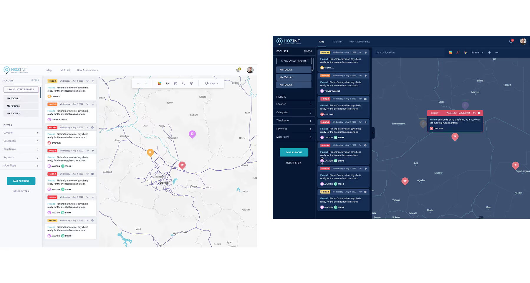
Our work began with a scoping session to understand how analysts process continuous data streams from over 10,000 sources and assess threat severity under time pressure. We focused primarily on the interaction layer - Product Design and Frontend - to transform this vast dataset into an accessible operational tool. The legacy interface struggled with information density, making it difficult to distinguish severity or location at a glance. To address this, we introduced a cleaner, modern structure built around strict visual hierarchy and improved contrast. We prioritized the visibility of key elements such as alert titles, timestamps, severity ratings, and geographical locations while restructuring the navigation to minimize the clicks needed to access critical features. By unifying the experience across AI-generated and human-verified alerts, the redesigned interface reduces cognitive load, supporting long hours of monitoring and helping analysts recognize emerging patterns sooner.
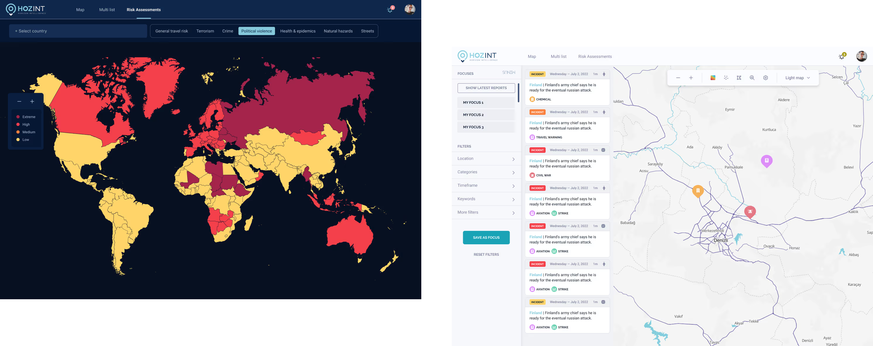
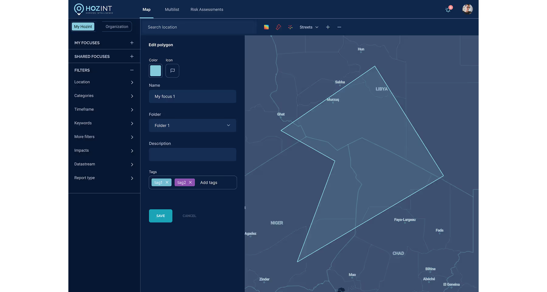
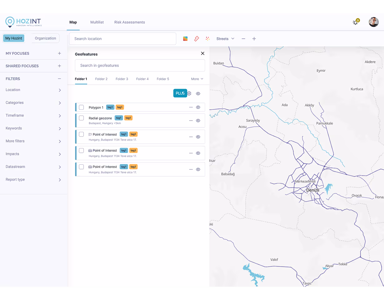
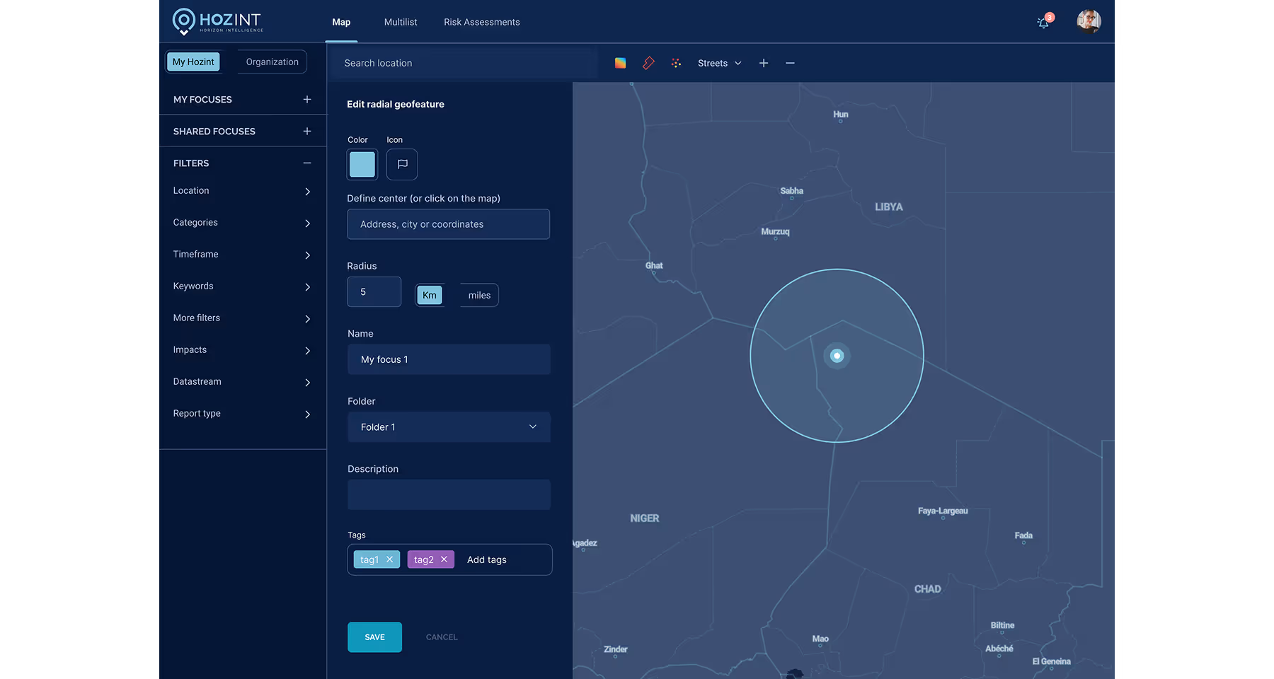
Since the interactive map is the central hub for monitoring regional safety, we focused on rebuilding this layer to support more advanced geospatial analysis within the client's architecture and budget. We utilized MapLibre to construct a responsive navigation experience, implementing essential features like polygon drawing, geofencing, and intelligent incident grouping. A significant technical challenge involved developing a custom geofencing tool that allows analysts to precisely draw and select specific areas of interest directly on the map. In terms of design, we concentrated on unifying the visual consistency of the client's existing views, ensuring that the complex geospatial data remains clear and accessible.

What I found most impressive about this company is the exceptional quality of their work. Every project is handled with precision and care, ensuring top-notch results. Additionally, the communication process is remarkably streamlined, making collaboration smooth and efficient. The team is incredibly easy to speak to, always approachable and open to feedback, which makes working together a truly positive experience.
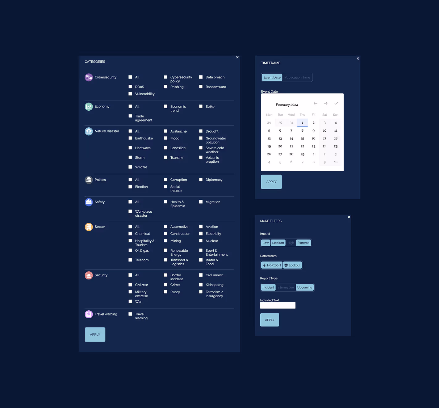
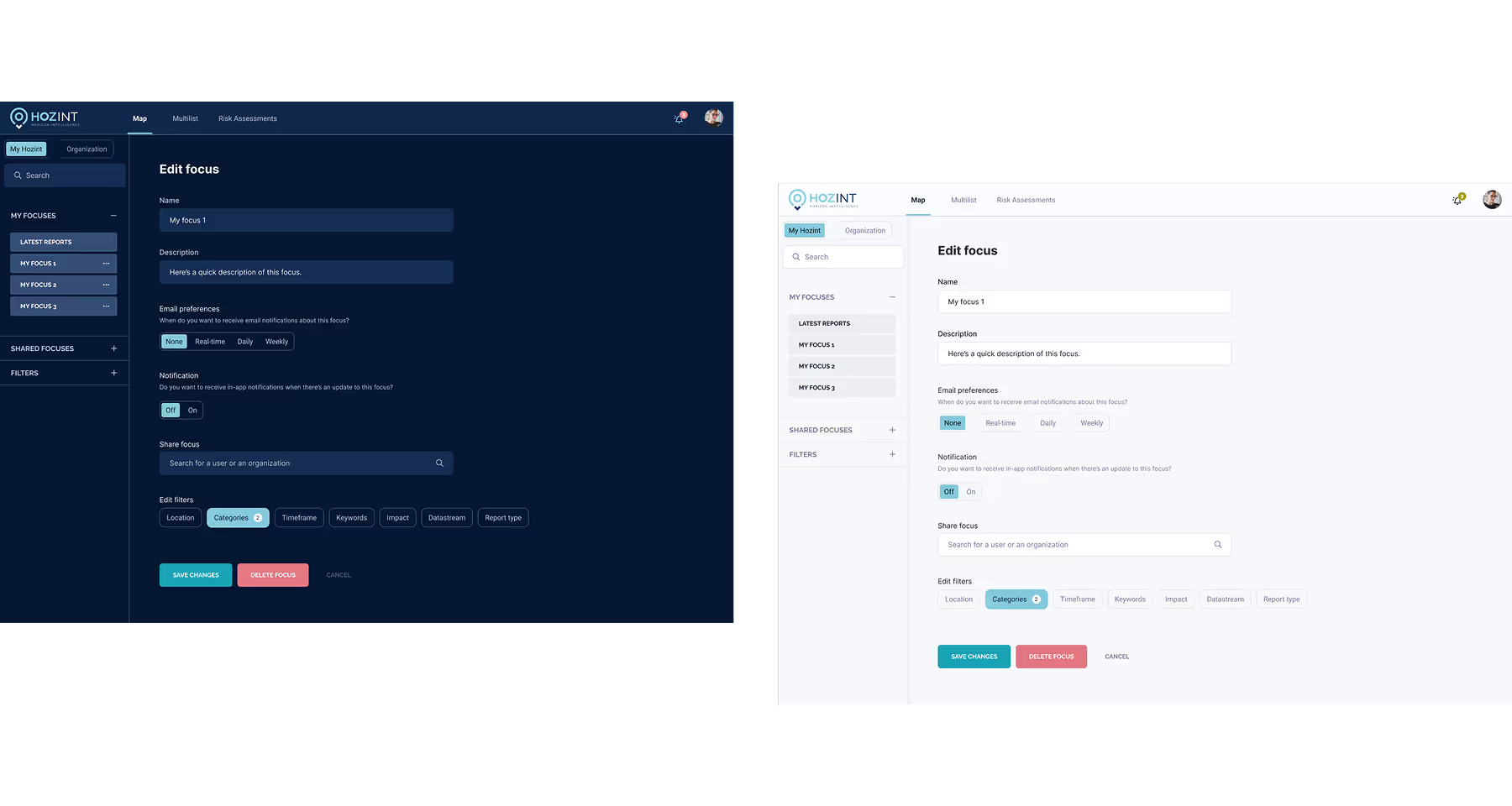
To help users cut through the noise of thousands of daily incidents, we improved the existing filter options to allow for precise sorting and filtering by location, incident type, threat level, and more. The upgrade focused on refining "Focuses" - saved, multi-criteria queries that allow teams to define, share, and edit specific threat scenarios subject to viewing permissions.
We implemented customizable alert thresholds, ensuring users can isolate and focus on relevant security incidents based on their specific operational needs. Crucially, we ensured real-time interaction with data without delays, incorporating a drag-and-drop interface that lets users effortlessly rearrange alerts based on priority or location. Additionally, we developed a dedicated Risk Management module that enables users to visualize distinct threat categories and compare safety indices across different countries, offering a strategic macro-view alongside tactical monitoring.
The modernization effort delivered a platform that feels more intuitive, predictable, and faster for both new and experienced users. With smoother performance and clearer data presentation, users can now explore risks more deeply while staying aligned with their organization’s intelligence objectives. Our collaboration continues as we shift focus to mobile accessibility; we are currently developing an MVP of a mobile application featuring core functionalities requested by users, with plans to expand its capabilities based on evolving needs.
A rebuilt map interface using MapLibre, serving as the central hub for global threat monitoring.
Visual tools for comparing risk levels across countries and categories to support strategic assessments.
Tools for drawing custom polygons and areas on the map to isolate and analyze specific geographical zones.
A system to create, save, and share complex filter sets (Focuses) based on threat type, location, and time.
Seamless presentation of both AI-generated (instant) and human-verified (highly accurate) alerts.
.svg)
.svg)
.avif)

.avif)
.avif)
.avif)
.svg)


.svg)